Southeast Washington County Dryland
Cope, CO 80812
Washington County, Colorado
Shown by Appointment Only
Ranch Description
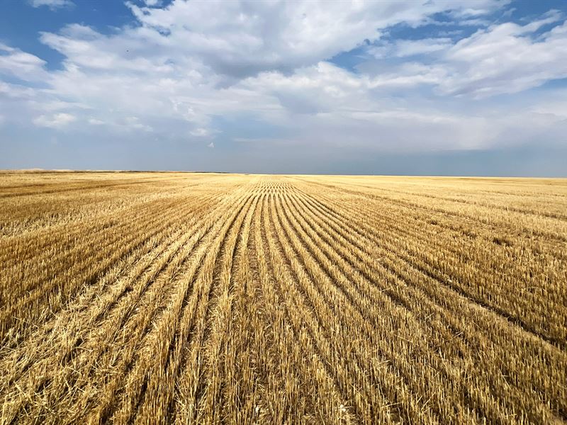
Productive dryland section currently in wheat stubble, located 23± miles south of Otis, CO or 6± miles north of the Arickaree School. County Road PP borders the section on the east and trail roads border it to the north and south. 640± assessed total acres; 628± tillable acres. Mineral rights previously reserved. Possession upon closing.
640.0± total acres
628.8± tillable acres currently in wheat stubble
11.2± acres grass, gas wells & roads
Washington County, Co
Located 6± mi north of Arickaree School or 23± miles south of Otis, Co
2 miles west of paved County Rd RR; County Rd 17 west to County Rd PP north 1 mile
FSA Base: 79.80 ac wheat at 26 bu PLC yield; 13.20 ac grain sorghum at 20 PLC yield; 23.30 ac barley at 27 PLC yield
R/E Taxes: $953.90 (2024)
Legal: Section 31, T2s-R50w
Full possession upon closing
Mineral rights previously reserved
Ranch Maps & Attachments
Directions to Ranch
Directions: From Otis, CO - 20± miles south on paved Co Rd RR to Co Rd 20, west 2 miles on Co Rd 20 to Co Rd PP, south on Co Rd PP 1 mile to NE corner of property; From Hwy 36 - 9± miles north on paved Co Rd RR to Co Rd 17, west 2 miles on Co Rd 17 to Co Rd PP, north on Co Rd PP 1 mile to SE corner of property.
More Ranch Details
More Ranches from Marc Reck
 635 AC : $996K
 13,424 AC : $11.75M
 110 AC : $595K
 1,943 AC : $4.03M
 3,728 AC : AUCTION
 397 AC : $400K
 160 AC : $220K
